What if you could see through petabytes of data?


REINVENTING|AS YOURCOPILOT
Infrastructure Security
AI assisted on-demand aerial reconnaissance for safer, optimized highways
Emergency Response Coordination
Respond faster with real-time situational awareness, threat detection, and coordinated multi-agency protocols
Advanced Wildlife Monitoring & Conservation
Tack wildlife movement, biometric data, and habitat conditions for successful conservation and rewilding programs
Automated Asset Quantification
Optimize quantification of copper spools, available land areas for effective resource allocation
Urban Intelligence Platform
Predictive analytics with integrated IoT sensors & automated city services for enhanced quality of life
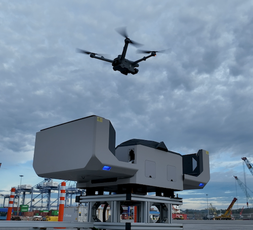
Autonomous Port Operations
Ensure autonomous cargo safety, vessel traffic management, and integrated supply chain coordination
<Autonomous decision support/>
Our Mission
We simplify aerial operations to give you visibility for decision making
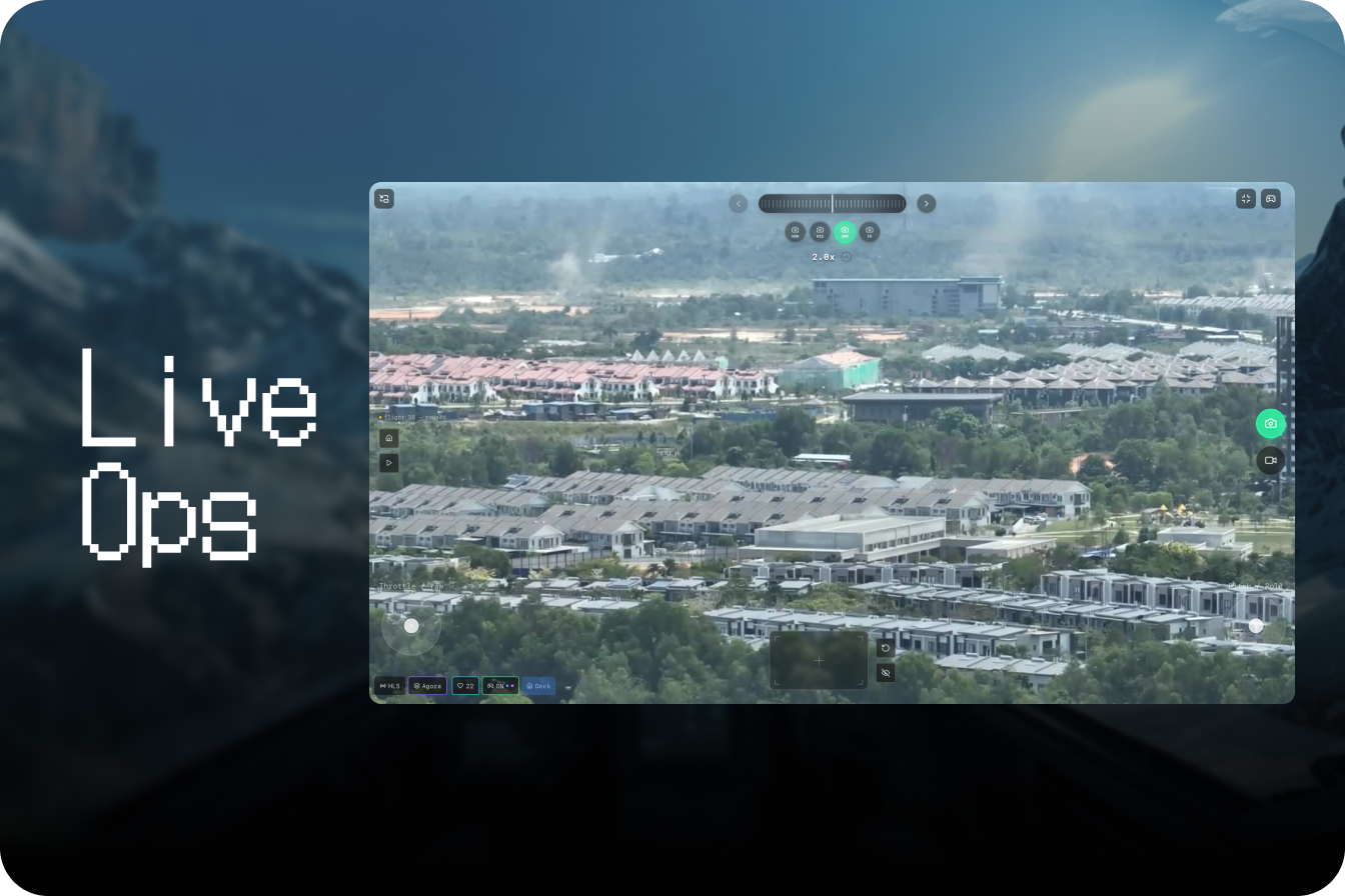
Faster Response Times
Send a drone to points of interest, anywhere around your asset, in less than 3 minutes
Multiple Drones & Stations
Cover large areas all at once, through a network of stations housing multiple drones & robotics systems
BVLOS-first approach
Completely remote operations with advanced autonomy
Best-in-class Hardware
Exclusively provided and included in one easy-to-use contract
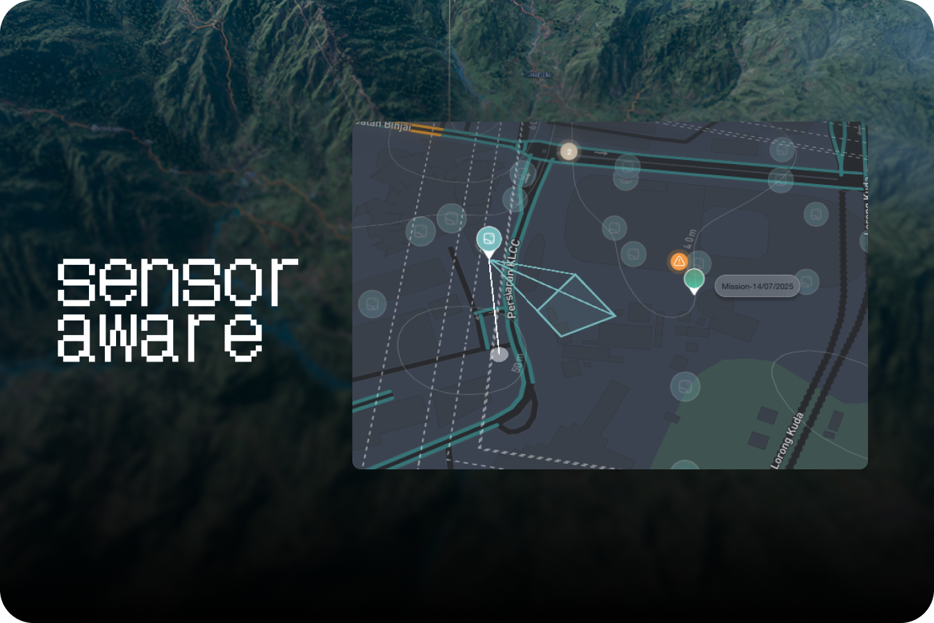
Agentic AI
AI overlays give teams & first responders insightful context to make informed decisions on the field
Automatic response to triggers you define
Use calls, text, or threshold values from your sensors
Fully remote flight operations
Beyond visual line of sight
Live insight for key stakeholders
Data-driven outcomes
Next-Generation Intelligence Platform
Harness the power of AI, edge computing, and real-time analytics to transform your operational capabilities
Accelerate Your Decision Cycle
Real-time intelligence processing with AI-powered analytics for rapid decision making in critical situations.
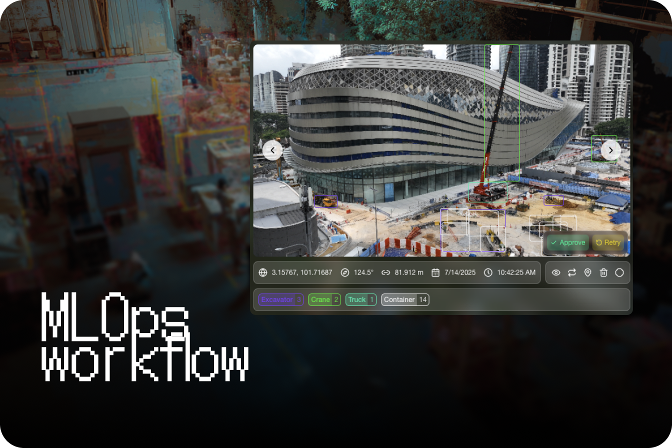
Intelligence That Learns
Machine learning algorithms that continuously improve threat detection and pattern recognition capabilities.
Mission-Critical Security
Enterprise-grade security with end-to-end encryption and compliance with military standards.
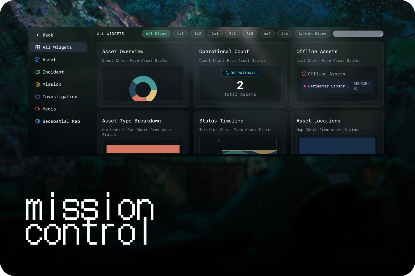
Global Operations Center
Centralized command and control for worldwide operations with real-time coordination capabilities.
Edge Computing Power
Distributed processing capabilities that bring intelligence closer to the point of action.
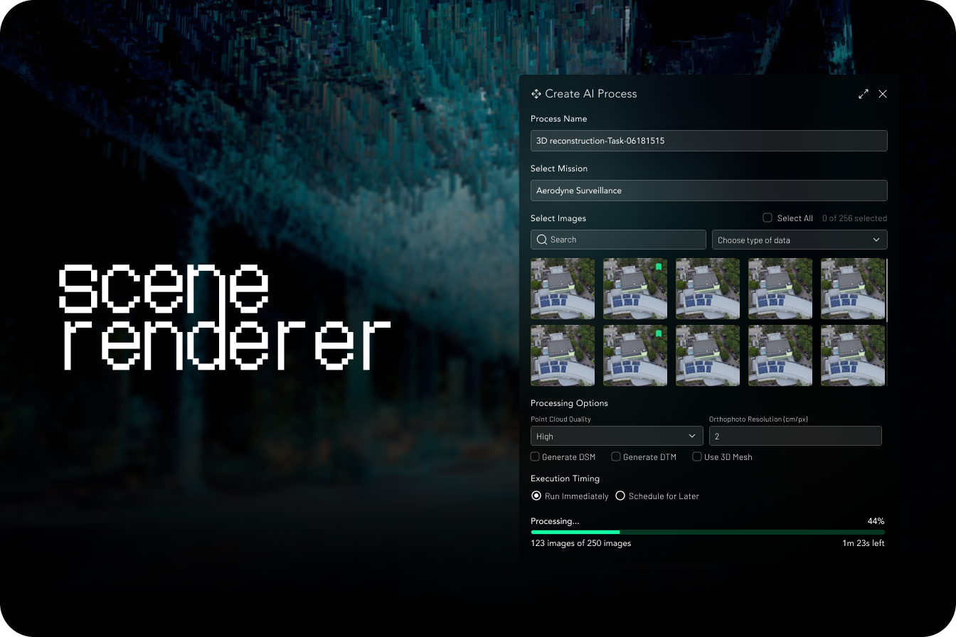
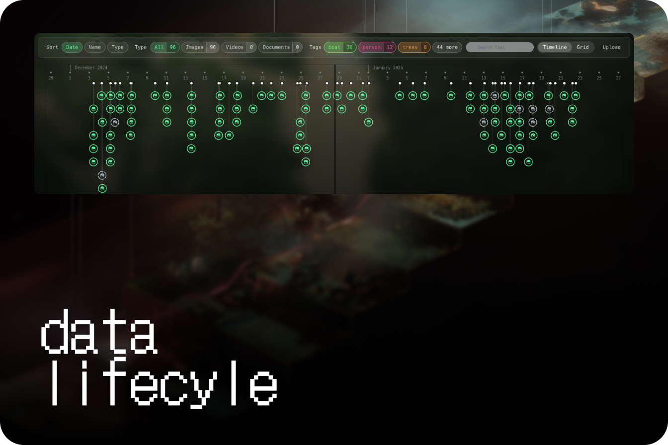
Advanced Scene Analysis
3D reconstruction and analysis of operational environments with precision mapping capabilities.
single engine, various needs
Multi-modal by design to give asymmetric returns through geospatial intelligence


BVLOS? No problem
Seamlessly integrate with leading drone platforms and automated systems. Our platform supports a wide range of hardware for maximum operational flexibility.
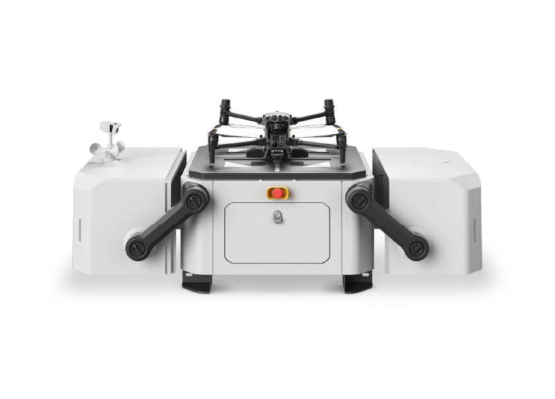
DJI Dock 1
Compact autonomous drone docking solution for 24/7 remote operations, featuring automated charging and data transfer for routine missions.
Key Specifications
Capabilities
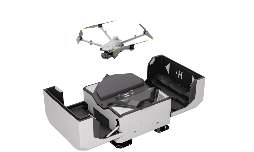
DJI Dock 2
Advanced, more portable industrial-grade docking platform designed for agile, multi-dock operations and efficient fleet management.
Key Specifications
Capabilities
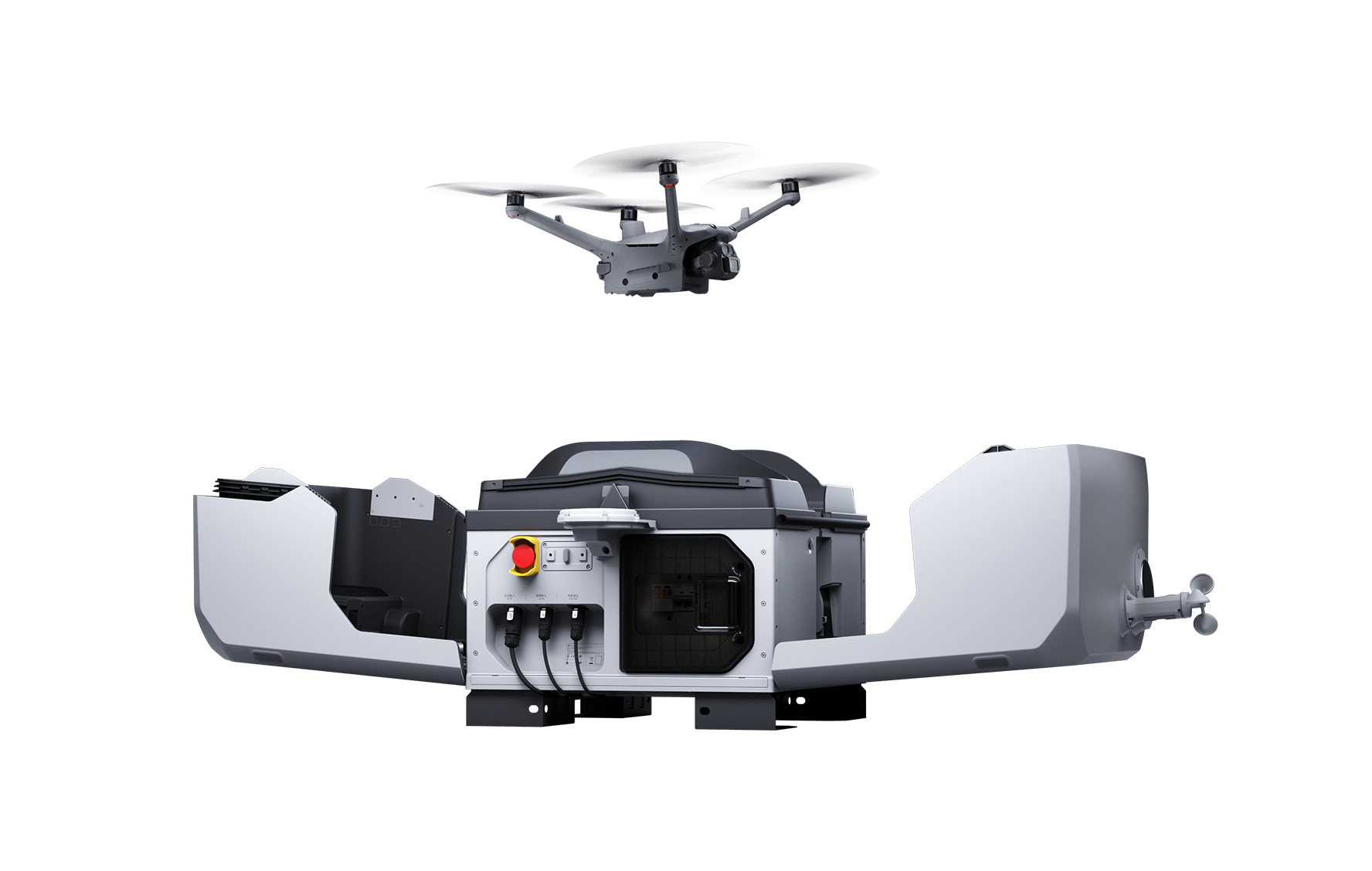
DJI Dock 3
Heavy-duty enterprise solution for large-scale operations, offering maximum reliability and advanced orchestration for coordinated drone fleets.
Key Specifications
Capabilities

Autel Dragonfish
A versatile VTOL drone offering long endurance and high-speed flight, ideal for diverse industrial applications.
Key Specifications
Capabilities
Don't see your hardware? Contact us for custom integration support.
Flexible Deployment Options
Enterprise-grade security and compliance certifications across all deployment models
Cloud Deployment
Scalable cloud infrastructure with global reach
Hybrid Deployment
Best of both worlds - cloud and on-premises
On-Premise
Complete control with local infrastructure
Air Gap Deployment
Maximum security with isolated networks
Enterprise Security & Compliance
Moving towards industry-leading security standards and regulations
Qualified Software Partner with AWS

Service Organization Control Type 1
Service Organization Control Type 2
Information Security Management System

General Data Protection Regulation
Growing Ecosystem
Seamlessly integrate with industry-leading platforms, tools, and partners to create a comprehensive geospatial intelligence workflow.